You have not accepted cookies yet

This content is blocked. Please accept marketing cookies. You can do this here.

Travel-IQ, Arcadis’ Advanced Traveler Information System (ATIS), enables public agencies to efficiently report and manage travel-impacting events like roadwork, accidents, and special events. It communicates these updates to regional stakeholders and the public via web and mobile apps, third-party travel apps, social media, and personalized alerts. Travel-IQ also helps users visualize road network status, including incidents, closures, congestion, camera feeds, road conditions, truck restrictions, bridge alerts, and more.

Want to learn more?

Key features

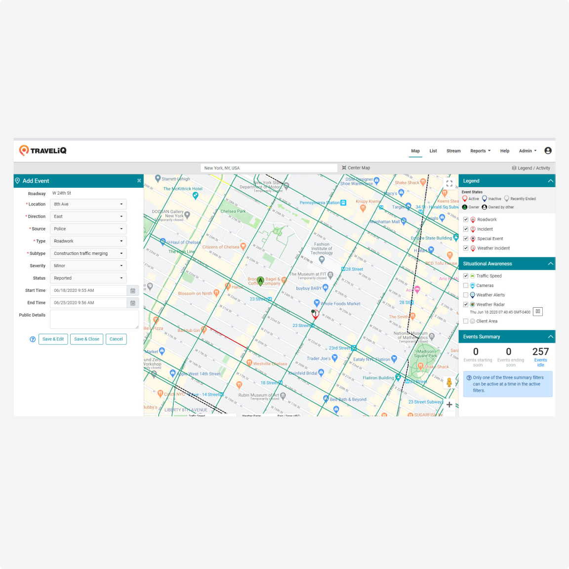
A detailed map showcasing multiple layers of the city, highlighting various districts and landmarks for navigation.

User Friendly Event Reporting and Management 


Travel-IQ streamlines incident and event reporting for public agencies, minimizing clicks and manual data entry. Users can quickly generate events by clicking on a map location, with automatic location details from the HERE map platform. The familiar map interface enhances situational awareness with traffic speeds, weather updates, and live camera feeds, and users can even report from the field using Travel-IQ’s mobile event reporting system. 


A man seated on a bench, surrounded by his luggage, while using his cell phone.


Consistent Communication to a Wide Audience 


Travel-IQ ensures consistent messaging across all channels by automatically generating event information for agency staff, regional stakeholders, and the public. Events can be easily published to the Travel-IQ public website and mobile app, third-party travel apps like Waze, social media, and via SMS or email. 


Aerial view of a busy freeway filled with numerous cars, showcasing the flow of traffic from above.


Advanced Data Integration 


Travel-IQ integrates with various data sources, supporting advanced event management, reporting, and alerts for road and bridge restrictions. It tracks the event lifecycle and can manage first responder vehicles, while also offering extensive reporting capabilities and mobile app functionality for event management in areas without data service. 


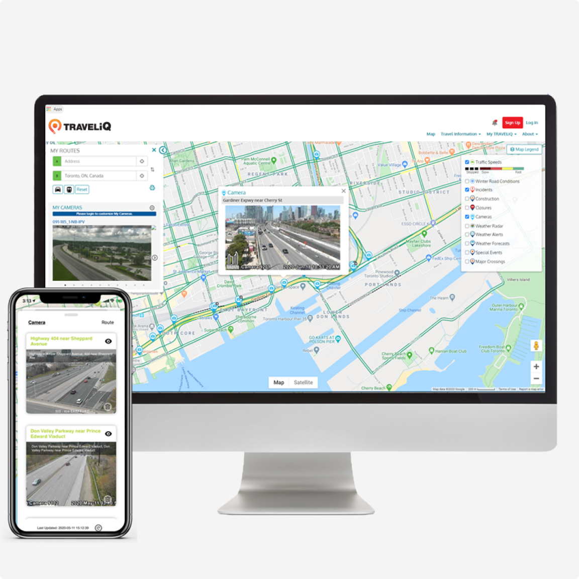
Geotracking software interface displaying real-time transportation data and route optimization features for efficient logistics management.


Travel-IQ Website, Mobile App, and Personalization


The responsive Travel-IQ website and mobile app provide optimal viewing and trip planning on any device. Users can access advanced mapping, navigation, and real-time traffic alerts, and create personalized accounts to receive tailored notifications for their regular routes.


Benefits

Simplified Event Creation and Management

Simplified Event Creation and Management

Create and share planned or unplanned events across multiple channels, including the Travel-IQ website, email, SMS, mapping apps, and social media—all in ten clicks or fewer. 
Consistent Alerts to a Wide Audience

Consistent Alerts to a Wide Audience

Automatically generate and edit alert messages to ensure uniform communication across all platforms to both internal and external audiences. 
Single Interface Across Departments

Single Interface Across Departments

A single interface allows all departments (police, fire, public works, etc.) to share a comprehensive view of events. 
Public Access to Agency Verified Data

Public Access to Agency Verified Data

Provide real-time, agency-verified event information tailored to the public’s preferred communication methods. 
Flexible and Comprehensive Data Layers

Flexible and Comprehensive Data Layers

Integrate and customize data from various static and dynamic sources to meet agency needs. 
The Travel-IQ 511 product had all of the features the state required with very little customization needed, so moving forward to update our existing 511 system was a win/win.
{{i_item.AuthorName}}
Lissa Idell-Sassi
ADOPT&PF/TRANS DATA PROG - HPMS MGR

Travel-IQ Mobile App 

Access extensive traveler information and much more, with the Travel-IQ mobile app. 
Hands-free, personalized, geo-targeted voice traffic alerts presented in an easy-to-use interface with simple, one touch navigation. 


Projects

Want to learn more?

Trusted by municipalities, provinces and public infrastructure owners and operators globally:

Transportation & Public facilities state of Alaska icon
ADOT logo
FDOT logo
Yukon logo
New York City  Dot
Ontario logo

Connect with our digital experts

For questions, demos and requests for proposals, please get in touch with us.

our team

Connect with our team for more information & questions.

Connect with {name} for more information & questions

Arcadis will use your name and email address only to respond to your question. More information can be found in our Privacy policy